WHY
HERE?
Events cannot be told apart from their places
Listen to the voices of those who lived there
StartInquiry
Don't just 'look' at maps - experience the choices our ancestors made through terrain conditions.
Phenomena, themes & experiments
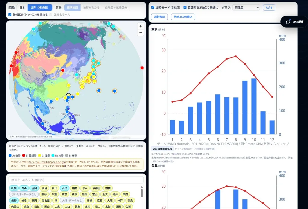
Climate Compare Map
Compare two places with climographs from verified JMA, WMO, and CWA normals (1991-2020). Japan stations plus a globe view of world cities.
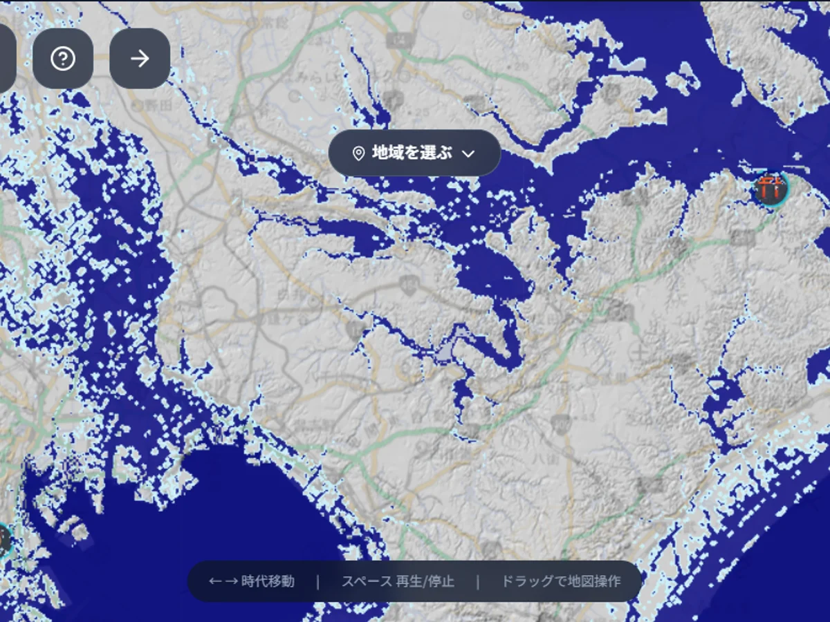
Coastline Time Machine
From the Ice Age to today. How sea level changes shaped Japan and people's lives.
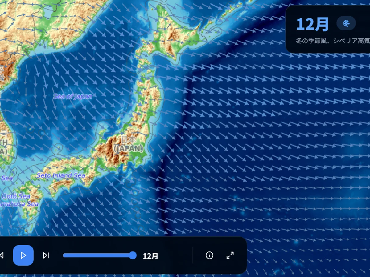
Monsoons, Jet Streams & Currents
Visualized with ERA5 and OSCAR data. The atmospheric and oceanic circulation dominating the Indo-Pacific.
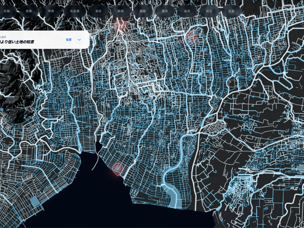
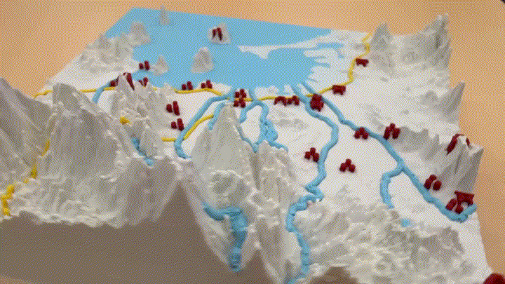
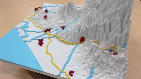
Water Network
Start by looking at water alone. Visualize the water structure that governs the Japanese archipelago.
Climate Compare Map
Compare two places with climographs from verified JMA, WMO, and CWA normals (1991-2020). Japan stations plus a globe view of world cities.
Coastline Time Machine
From the Ice Age to today. How sea level changes shaped Japan and people's lives.
Monsoons, Jet Streams & Currents
Visualized with ERA5 and OSCAR data. The atmospheric and oceanic circulation dominating the Indo-Pacific.
Water Network
Start by looking at water alone. Visualize the water structure that governs the Japanese archipelago.
Cities
Fukuoka 3D Terrain
Change the angle of light to discover history etched into the land. Explore Fukuoka with the 3D terrain viewer.
Kanazawa 3D Terrain
The castle town of Kaga Hyakumangoku. Read the Maeda clan's urban planning from the terrain between the Sai and Asano rivers.
Fukuoka 3D Terrain
Change the angle of light to discover history etched into the land. Explore Fukuoka with the 3D terrain viewer.
Kanazawa 3D Terrain
The castle town of Kaga Hyakumangoku. Read the Maeda clan's urban planning from the terrain between the Sai and Asano rivers.
Fukuoka 3D Terrain
Change the angle of light to discover history etched into the land. Explore Fukuoka with the 3D terrain viewer.
Kanazawa 3D Terrain
The castle town of Kaga Hyakumangoku. Read the Maeda clan's urban planning from the terrain between the Sai and Asano rivers.
How toAsk?
The art of nurturing 'Why?'
Learn how to transform vague questions into researchable ones.
- 01CULTIVATE
Evolve questions: v1 → v2 → v3
- 024 LENSES
Four lenses: When, Where, Who, Really?
- 03PRACTICE
Practice with guided missions
“Why were there so many fires in Edo?”
“Why were wooden houses standard for Edo townspeople?”
“Which spread fires more: dense housing or wind?”
How toCreate?
Sculpt, paint and shape terrain — right in your browser.
Your land becomes something you can hold, study, and tell stories with.
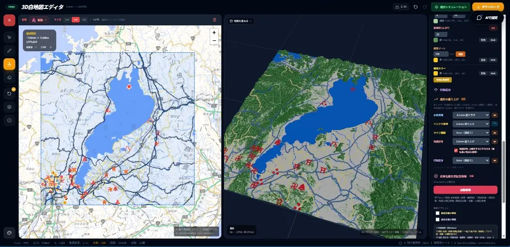
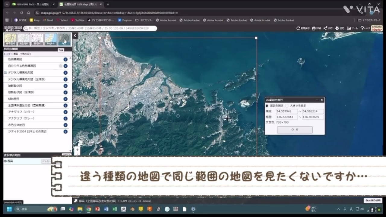
3D White Map Editor
Create and export 3D terrain models in your browser. Draw maps, overlay layers, preview in 3D, and output for education and presentation.
Colorful GBM Creation
Create colorful 3D terrain

GEO LAB
Under construction: browser-based map experiments for students
順次公開
AR
Project 3D terrain into real space with AR apps. Experience terrain intuitively in classrooms and field studies.
順次公開
AI
Terrain analysis and auto-generation using AI technology. Streamline inquiry-based learning.
順次公開
Layer
Overlay historical and geographic information as layers on 3D terrain. Visualize changes across time periods.
順次公開
Education Integration
Utilize GBM in geography and history classes. Perfect for inquiry-based learning presentations.
Colorful GBM Creation
Create colorful 3D terrain
GEO LAB
Under construction: browser-based map experiments for students
順次公開
AR
Project 3D terrain into real space with AR apps. Experience terrain intuitively in classrooms and field studies.
順次公開
AI
Terrain analysis and auto-generation using AI technology. Streamline inquiry-based learning.
順次公開
Layer
Overlay historical and geographic information as layers on 3D terrain. Visualize changes across time periods.
順次公開
Education Integration
Utilize GBM in geography and history classes. Perfect for inquiry-based learning presentations.
IntelligenceArchives
Every "why?" begins right here.
One click opens a doorway that quietly changes how you see the world.
Free official resources
Inquiry layers
Curated by teachers & researchers
One click. A world you didn't know was waiting.
Expert Perspectives
Coming soon. Read primary sources alongside the experts.